Coondle Reserve
Area: 26 ha
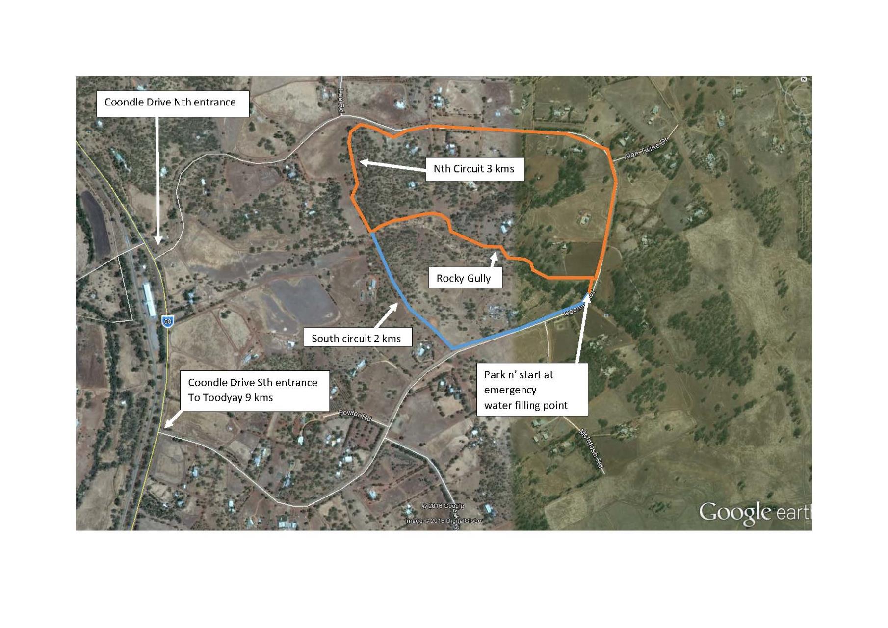
Walk distance:: North circuit 3 kms, South circuit 2 kms.
Through the centre of the reserve, the rocky creek line features granite outcropping and a seasonal waterfall and rock holes. Both circuits allow you to explore this point of interest. Flooded Gum grows along the creek line while the hillsides sport Jam Wattle trees.
Used for grazing since the early days of settlement the reserve has lost much of its original vegetation. Be prepared for some steep descents and climbs. Both circuits return via Coondle Drive where you get high views across the Toodyay Valley but watch out for traffic.
Facility Snapshot
Features
- Accessible
- Walking Trails Unpaved
Contact
Shire of Toodyay
(08) 9574 9300
records@toodyay.wa.gov.au
Location
View Map