Golf Course Walk
Walk Circuit Distances 3.5 and 4.5 km
The Golf course land is Shire owned covering nearly 200 ha of some of the most rugged terrain in the district.
The steep, bush covered hills and valleys that surround the fairways provide exceptional walking and nature study opportunities. Traversing this terrain is not for the feint-hearted. It is recommended that you have a fair level of fitness and are well prepared and attired before walking here.
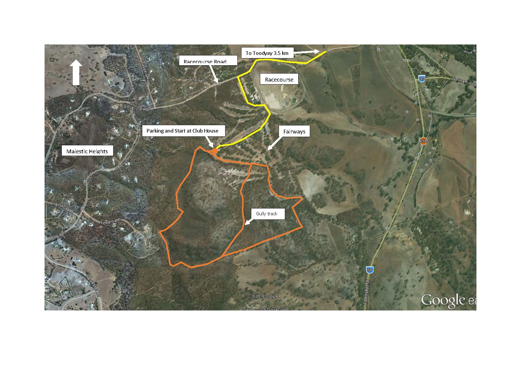
Access the Golf Course off Racecourse Road passing the buildings and follow the signs to the Golf Club House. Park here and ascend the fire break that runs up behind the Club House making sure you are travelling south westerly. At the top turn left along a private property boundary. Here you leave the track and descend southward through a bush covered rocky slope for 250 meters to intersect a fire break at the bottom. Turn left and follow the fire break for 300 meters until you reach an eroded gully.
Pick your way along the gully for a kilometre or so and you will be treated to some extraordinary geology. The depletion of the vegetation on the upper slopes due to the effects of the 2009 fire has allowed severe water erosion to expose layers of the beautiful and unique Toodyay Stone creating a mini, gorge. You will eventually emerge onto a fairway whereupon it is an easy stroll back to the Club House.
An easier but longer alternate route is to keep following the boundary fire break back to the fairways. Wild flowers are plentiful here in spring. Remember to take drinking water with you.
Facility Snapshot
Features
- Accessible
- Walking Trails Unpaved
Contact
(08) 9574 9300
records@toodyay.wa.gov.au
Location
Racecourse Road, Toodyay 6566 View Map