Published on Thursday, 3 November 2022 at 3:00:00 PM
Chalice Mining Ltd. wishes to advise local residents of an Airborne Geophysical Survey taking place within the Shire of Toodyay and a small portion of the Shire of Chittering.
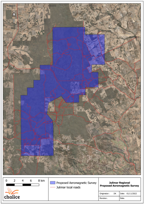
Chalice is planning to fly over areas of the Julimar State Forest and surrounds, commencing in mid-November 2022. Figure 1a indicates the area where the survey will be conducted, which may include some or all of your property. All Airborne Surveying undertaken is in line with Civil Aviation Safety Authority (CASA) regulations, including:
- Flights are restricted to daylight hours only
- Direct overflight of buildings or vehicles is not allowed, and the aircraft will deviate its flightpath around these obstacles
- When operating within 100 metres of any building or vehicle, the aircraft will pull up to a height of 300 feet. Once clear of the obstacle, the aircraft will descend back to survey height and continue
The entire survey is anticipated to take one week to complete, depending on weather and contractors.
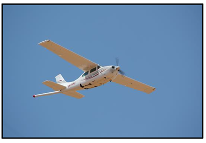
The survey will be conducted using a Cessna 210 (see image 1b) and will be flown at a height of 50 metres in a grid pattern. You may hear noise from the aircraft for a short period. Aside from potential noise, the survey will have little to no impact on the surrounds. The aircraft will not land on or contact private property, and will not fly directly over congregations of animals in pens or yards. If you see the aircraft, do not be alarmed - you are not required to take any action.
Airborne Geophysical Surveys are commonly flown throughout Australia and their primary purpose is to effectively screen large areas to define the geology and potential mineralisation.
If you are planning on undertaking any stock movements or have activities that could be impacted by our surveys over this time, please email community@chalicemining.com or call 9322 3960, so we can work with you to avoid disrupting your land use.
(Left to right)
Figure 1a: Map of Airborne Geophysical Survey area, scheduled for November 2022.
Figure 1b: Example of a Cessna 210 used for Airborne Geophysical Surveys
Back to All News